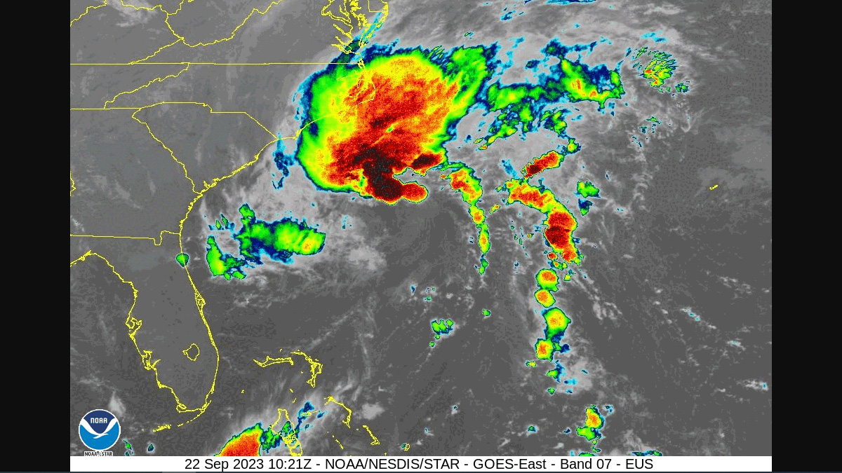
Tropical Cyclone 16 is on a transformation journey, poised to become Tropical Storm Ophelia by Friday, with its sights set on a direct hit with the Carolina coastline.
As of the 8 am update this morning, the storm is flexing its muscles with winds of 50 mph, and is flirting with the coast off Charleston as it meanders North West.
The latest forecasts paint a dramatic picture for most of the Carolina coast line, with flash flooding, form of rip currents, and high surf along the beaches this weekend.
Several hazards will be in place today for parts of SE SC/GA and coastal waters as Potential Tropical Cyclone Sixteen develops/tracks north of the area offshore. Most local impacts will come in the form of rip currents and high surf along the beaches. #scwx #gawx #chswx #savwx pic.twitter.com/1GMYTZzw1B
— NWS Charleston, SC (@NWSCharlestonSC) September 22, 2023
NWS officials are reminding all residents in Atlantic Coast states to be prepared.
In case of a power outage, make sure to have the following emergency items stocked in your home;
- Car charger for cell phones and other devices
- Clean drinking water (recommended 1 gallon per person per day, minimum three days)
- Flashlights
- Batteries: Extra batteries for all of your devices
- Weather radio/clock
- Non-perishable food
- First aid kit
We will continue to update this article as this storm develops.


